# Dam Level
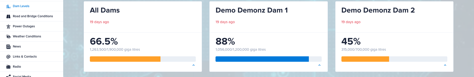
The Dam Level CT allows you to display the storage and capacity levels of dams within your council region. See the below reference for an example of what the page may appear as on your dashboard.
# Name
NOTICE
Used internally, not visible to visitors.
Changing not recommended.
The first ‘Name’ field is used for internal reference as a naming convention for the page. Ensure the chosen name is easily recognisable and associated with the page.
# Dam Level
This CT can have multiple dams.
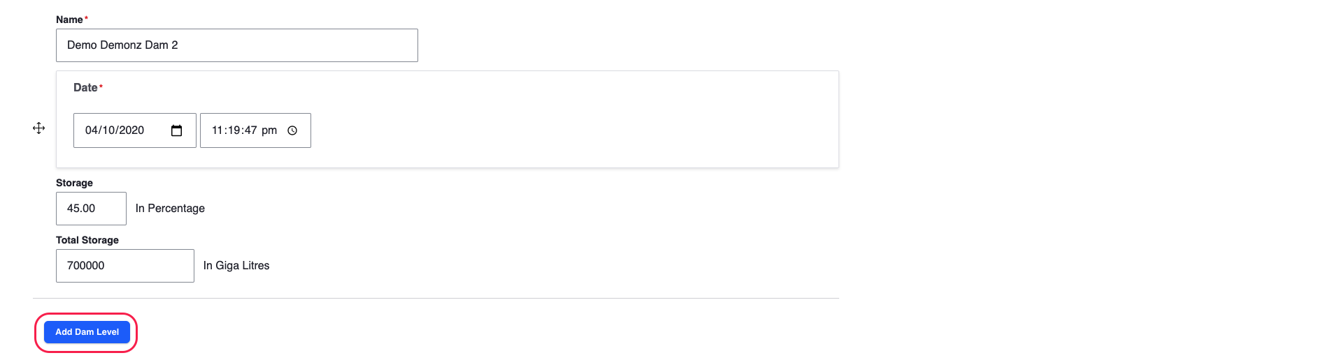
To create a dam level just click Add Dam Level button.
TIP
If more than one dam is added All Dams will be created automatically, totalling/averaging the values.
# Name
Name of the Dam, which is shown on the dashboard Dam Level content page.
# Date
Use the Date field to show the time and date of when the inputted information on the Dam Level was last updated.
# Total Storage
This field requires a numeric input of the total number of giga litres (x1,000,000 litres) this dam can hold.
# Storage
This storage field will often be changed, as this represents the current capacity of the Dam’s water level. A numeric percentage input is required.
# Guidelines
Ensure that:
The total storage value is in giga litres.
The current storage level is in a percentage value.
# Restrictions
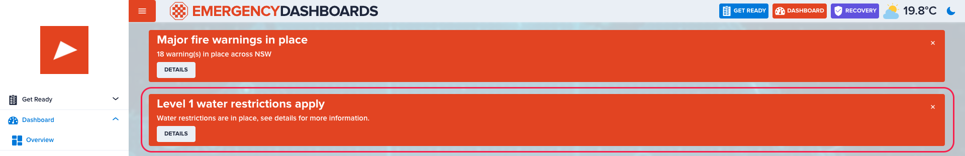
You are able to add multiple water restrictions. These restrictions are shown as a list and alert on top of the page, if current total dam level storage falls below threshold for one of the restrictions.
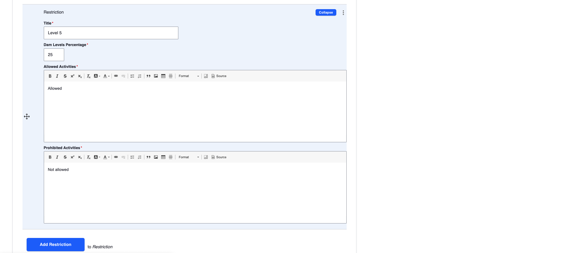
# Title
Name of the water restriction. Generally naming convention is Level X, where X is typically taking values 1 to 5, and higher value implies more severe restrictions.
# Dam Levels Percentage
The value which triggers restriction activation and alert on top of the page, if current total average storage value falls below it.
# Guidelines
- Strictly integer values between 0 and 100.
# Allowed Activities
Outline which water related activities are permitted at this specific restriction level.
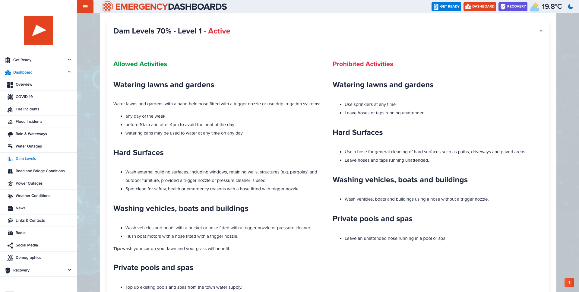
# Prohibited Activities
Outline which water related activities are disallowed (should be avoided) at this specific restriction level.
# Additional Restrictions
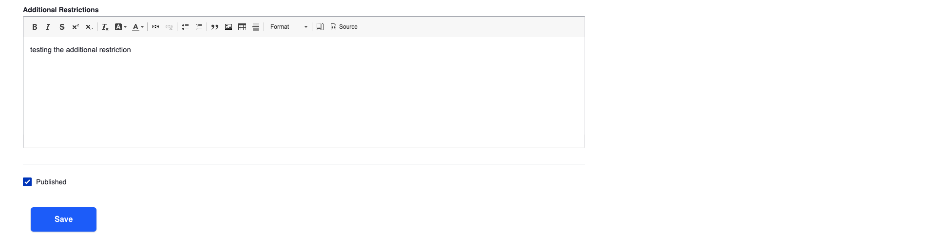
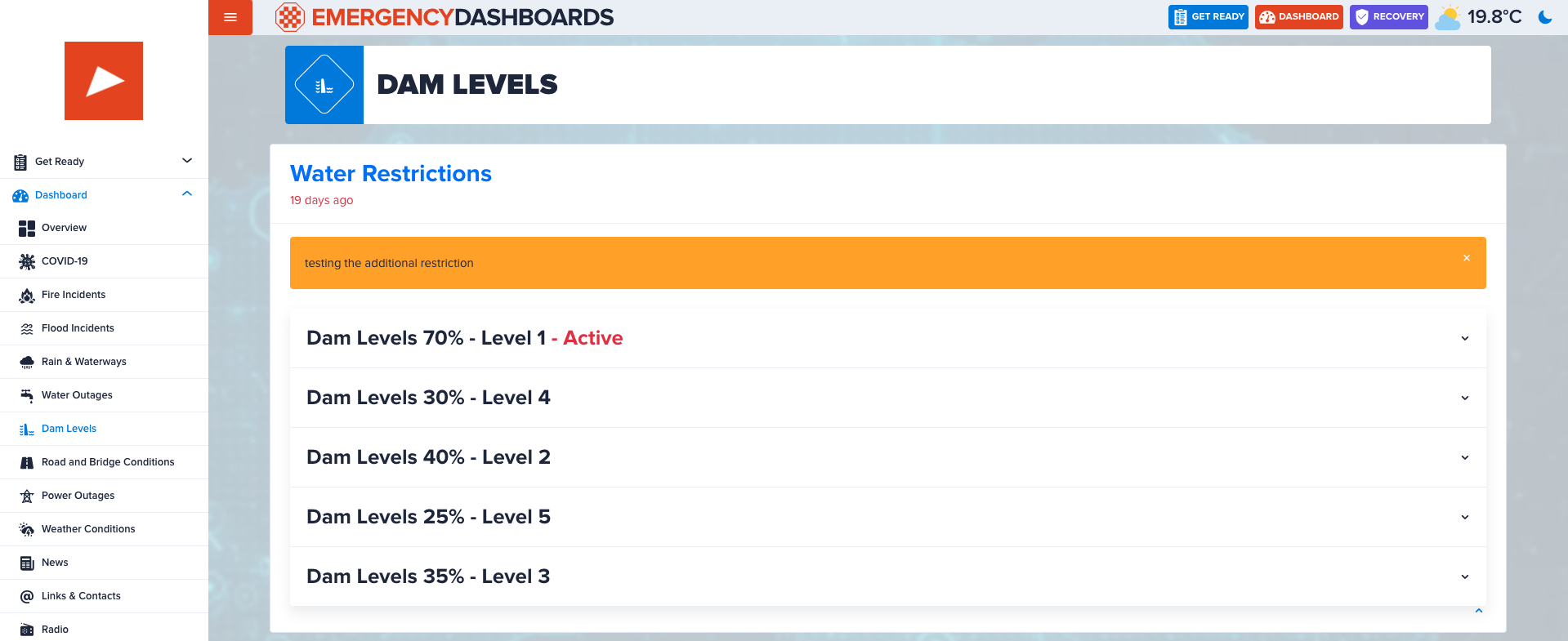
In addition to the restriction levels set above which get triggered automatically, you may create an additional restriction which will be displayed in the Water Restrictions widget.
← Road Closure Map →