# Water Outage
Using the Water Outage content type, you can manage information such as the location, water outage category and severity level.
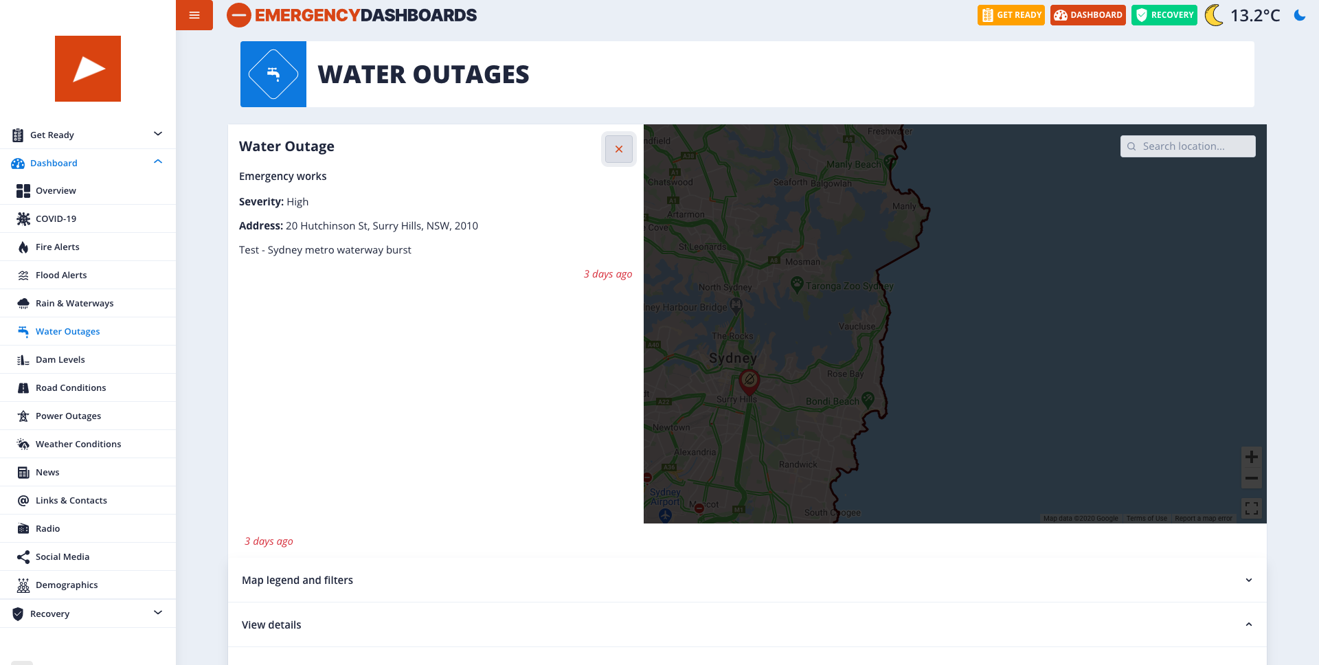
The following images show an example of how a water outage content page may appear in your dashboard once the below.

Once the pin on the map has been selected, a map sidebar with details of the water outage will appear (see below).
# Title
NOTICE
Used internally, not visible to visitors.
Changing not recommended.
Text included in the first Title field is for internal reference and will not appear externally to the public.
# Description
Under each Water Outage section added, is a text-based description field where you can outline the details of the water outage.
# Category
This field allows you to select different options from a drop-down menu. This includes ‘Emergency works’, which is associated with any unplanned, emergency water outages. While ‘Planned maintenance’ represents any planned water outages for maintenance purposes.
# Severity Level
This field allows you to select many different options from a drop-down menu associated with the severity level of the water outage. This ranges from; Low, Medium, High and Critical.
# Street Address
This field requires the street address details of the water outage location including country, street address, suburb, state and postal code.
# Location
This field allows you to input a geocode address which displays the location of the water outage on a map in the dashboard. The latitude and longitude fields will automatically appear once the geocode address is inputted.
# Guidelines
This field should be the same address inputted in the street address section above it.
# Outage Date
This field shows the date and time the water outage occurred or when the information on it was last updated. The date can be selected from a calendar drop down option or typed.
← Alert Road Closure →